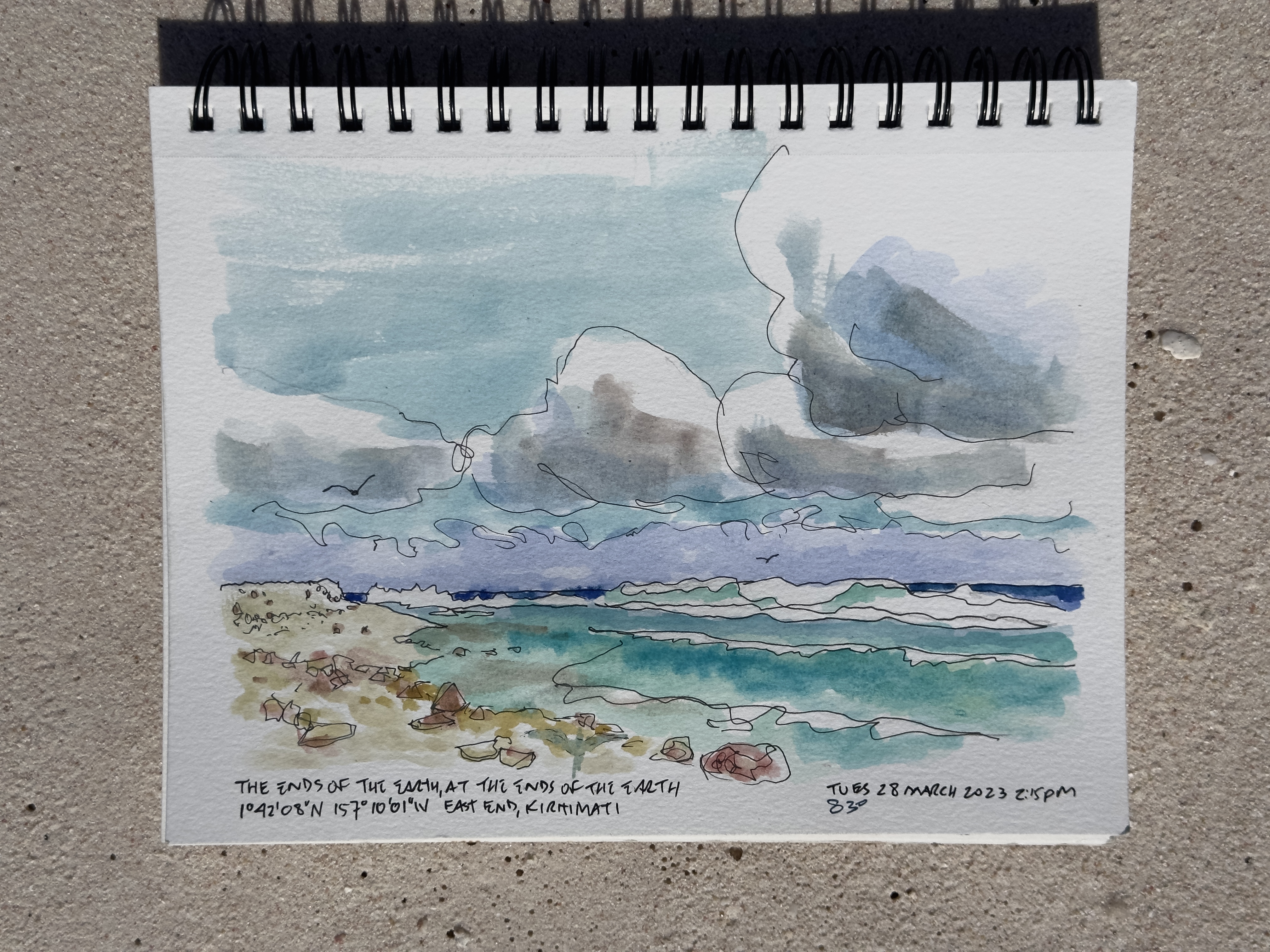
Tuesday, 28 March 2023, evening // The Ends of the Earth, at the Ends of the Earth
2pm?
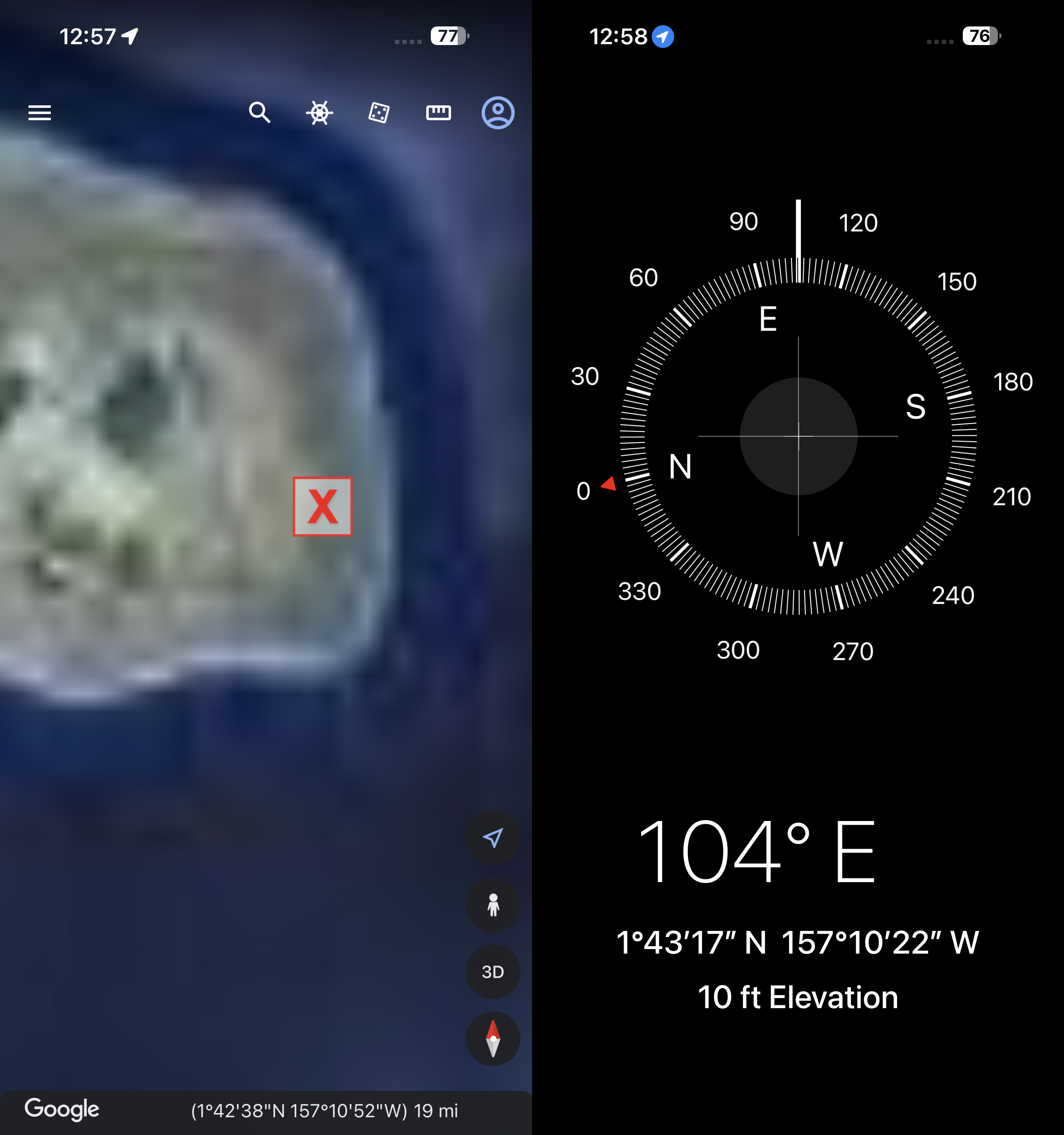
1°42‘08“ N
157°10‘1“ W
It is gorgeous.
(To Robin) I’ve been thinking (about you) a lot on this ride. Of marriage and romance and what those mean (to you, and what you wish for yourself.) On a daily basis I think of my grandfather, having written from Christmas Island to a woman in Beaver Falls, Pennsylvania, whom he had never met, asking her to marry him — at Fr. Rougier’s suggestion. By the time he received her last letter – August, 1918 – it seemed she was more than open to the idea.
Suddenly the distance between me and the water has been cut by half. The tide is coming in. The water is ten feet away.
______________////|__________________////|____
I lost all data logged between here and east point.
I left London at 10:55 AM. I think I got here around 1 PM.
I’m pissed off. I am not pissed off. I’m just upset that I lost all the data regarding getting here. The timing, the fact that my odometer stopped working long before I reached Main Camp, after leaving London and heading east.
The notation about the miles of a double row of coconut palms somewhere east of Joe’s Hill, running perpendicular to the road, and maybe a quarter-mile away, sometimes closer. Sometimes a half mile away.
The notes about the birds, the flock, the eggs.
I’d been working on a watercolor, and because of being unable to see my phone screen well, or read due to the sun, so bright, I somehow deleted all my text. The text I started writing to Robin.
The end of the world at the end of the world! Where I gathered sand for myself, Robin, for Rebecka.
Longitude and latitude?
3:55 PM the end of the earth at the end of the earth. Firing up this bike and heading out.
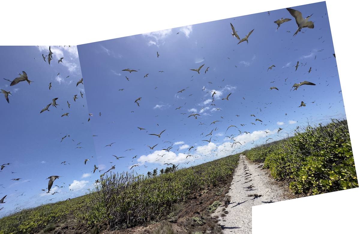
It’s 4:15. Going through that last sooty tern colony was amazing and scary and no doubt they didn’t like it either.
Speedometer starts working right after I left the colony, heading west, at 17 miles.
At 25 km. I am on the Aeron runway which I did not see before, it having been on my right as I rode the length of the peninsula. Now it was on my left coming home. There was no apparent signage. Yes, there is an old concrete marker, but it’s not apparent.
km 27 through 33: Two rows of palm parallel to road on lagoon side.
40.2 km Joe’s hill. 5 PM
45.1 odometer gives out again just before Carver way. It’s 5 PM
Casualty report: one egg, one tern.
53.6 km 5:13 PM
Main Camp 5:28
depart JMB Store 5:49 PM
6:14 PM odometer broken 61.2 km Bay of Wrecks.
Stopped in Tabwakea for corned beef and jelly at the “Chinese” store. Lose both on ride home as they bounced from the basket on the rear of my motorcycle. Motherfucker.
Locals call it the “Chinese” store, as the owner, back in Tarawa, 2000 miles away, is of Chinese descent, has a Chinese name. Robin Kumkee is the son of the owner, and manages the grocery, along with the “hardware” or hard goods shop next door. The latter is where I bought my motorcycle. They also sell refrigerators, tools, lubricating oil, televisions.
6:45 PM 71 km London. Almost two hours since I left The Ends of the Earth at the Ends of the Earth. 30 min. Joe’s Hill to Main Camp 25 min. Main Camp to Tabwakea.
______________////|__________________////|____
The Ends of the Earth, at the Ends of the Earth. It’s one thing to be 3300 miles from San Francisco, 3800 miles from Australia, 5000 miles from South America and the same distance to Antarctica, 6000 miles to what was once called Canton, in China, but it’s quite another thing to be at the tail-end of an island where people rarely go. There’s no REASON to be there. There’s no food, water, amenities. No shade. Hell, the road to get there was paved at the end of the 1950, and is slowly being overgrown by the slow-growing scrub. Other than those people on the populated end of the island, far to the west, the closest one gets to other people is when the International Space Shuttle passes 250 miles overhead, and a few astronauts may happen to look down. If you want to feel isolated, this is the place, in the center of the Pacific Ocean.
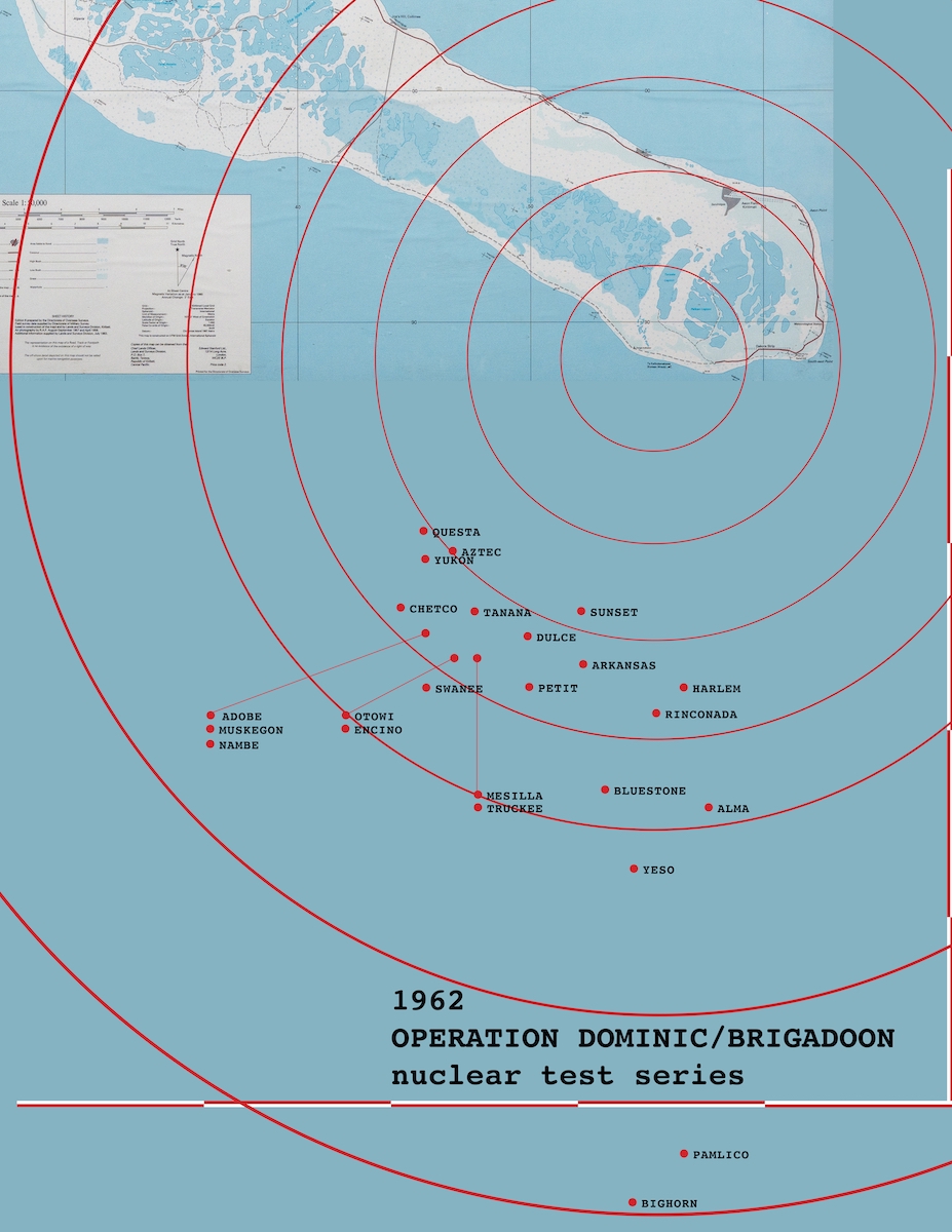
What I did NOT realize when I was sitting there, writing, painting, filming, was that just after I was born, the United States military dropped 25 atomic bombs from 15 - 25 miles from where I sat. Had I looked over my right shoulder, I’d have been blinded, and would of course have felt the heat and aftershocks. I’ve yet to find a chart depicting the US atomic bomb tests held at Christmas Island. Some were 400 times the power of those dropped on Japan in WW2. I cobbled this together based on longitude and latitude of each test, posted on Wikipedia.

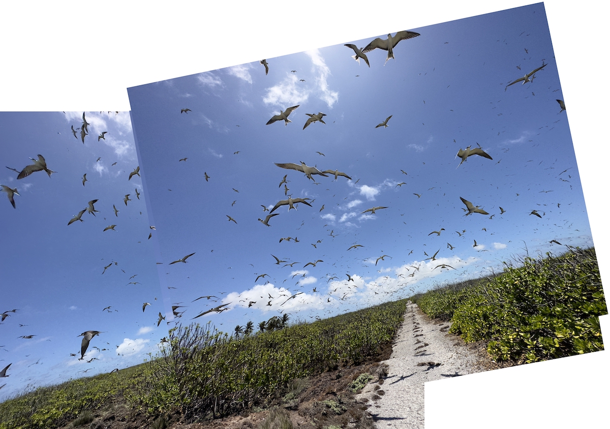

I’ve been aware of the bird colonies — those seen here are Sooty Terns — on Kiritimati for as long as I can recall. Yet, I’ve never looked into them in any way, other than to be aware there are places on the island that are off limits. I’d also read there was a time when those living on the island lived on both the birds and eggs they could find. I was not prepared for the actual conditions. First, the road is poor, only paved once, circa 1958, consisting of bitumen (boiling tar) which has been poured over a bed of gravel. Over the decades, the narrow, single-lane road has worn, and riding over it is much like riding a gravel road, albeit without spitting gravel. The terrain— a coral atoll whose “soils” and “sands” are essentially rocky coral that has ground down over millennia — is just shy of flat, with the slightest of inclinations and depressions. Sparse grasses, and “salt bush,” cover this end of the island. Salt bush is what the locals call Scaevola Taccada, in other parts of the Pacific known as naupaka. Acknowledged as a “first pioneer plant colonizer,” salt bush shows up on tropical beaches, in coral sands, growing from 9 - 30 feet tall, and just as wide. This is the most ubiquitous flora on Kiritimati, and covers most of the island. Here, on the southeast peninsula, were it not for the coconut palms planted over the last hundred years, the monotony of the “desert isle” would be unrelenting. Here, too, the salt bush is sometimes broken up by bare ground, a limestone hardpan that at times is as flat and level as poured concrete. It is here, on the ground between salt bush and hardpan, that sooty terns prefer to “nest.” That word is in quotes, as the birds do not build nests. Instead, they lay a singular egg wherever they feel like it. Oblivious to humans or their conditions, sooty terns will lay their eggs on roads and paths, making them not only easy pickings for humans, but also in danger of said humans. I was unaware of their egg-laying tendencies when I first rode into a colony, and by the time I realized how precarious it was for the creatures, I was already committed to a path that I’d have avoided, had I realized what was in store. The first time I saw a colony was on this day. Yes, I had seen them from afar, motoring past Cook Island from London toward Benson Point, and the Paris peninsula, but the birds were very much confined to a finite piece of land. On this day, I first spotted them from afar, looking like a cluster of bees or flies, darkening a spot on the horizon. Riding the bumpy road, I did what I’ve done for decades: found a way to negotiate both the throttle of a motorcycle with one hand, and a camera with the other. Almost 40 years ago, while an art student at Massachusetts College of Art, I’d road-tripped the length of Route 2, from Boston to New York, shooting slide film with a 35mm camera, while riding the highway. Forty years of practice allows for some degree of familiarity. In the case of motorcycles, and today’s technology, it means using a smart phone with left hand, while right hand twists the throttle, usually in second or third gear, as one cannot use the clutch if the left hand is engaged. Yes, one can “float shift”, “slip shift,” or perform clutchless shifting, by letting off the throttle all while applying pressure to the shift. But doing that all while trying to point, focus, and take a photo with a smart phone, which is hardly built for ergonomic photography, complicates matters. So no up or down-shifting. And no braking, as that’s one more function dependent on speed, balance, and most important, concentration and focus. Which means that when in a pinch, and braking and/or shifting is paramount to safety, the phone gets quickly jammed between my crotch and the seat. This is what happened: From a distance, I was riding at speed, maybe 20mph, as the road is so bad. I spy a black blur in distance, on the horizon, like a cluster of flies, but I realize it is a colony. I pull my phone from a pocket in my shorts as I ride, open the camera setting, and start filming, holding the phone in my left hand, right hand on the throttle. I don’t consider shifting, as my focus is on three things: not stalling, continuing to film, and realizing that as I continue to ride into the swarm, the birds are on the road, and I will be riding through them. The birds are all around me, not only already in flight, buy now disturbed as I continue to ride along the road over which they sit, oblivious to whether they are on paved road or in the brush. They are everywhere — on ground, in the air. Their sound, their flight, makes me recall the Alfred Hitchcock film “The Birds.” I’m not terrified, but I am concerned as to what will happen if I just find a way to stop in the middle of the road, in the middle of the swarm. I am surrounded by birds, and continue to ride, as they lift off the ground, dodge and swoop around me, chirping and calling. It takes 30 seconds to ride along the road that runs through the middle of their colony, and while It’s exhilarating, I don’t like it. I don’t want to harm the birds — which scatter as I approach — but also fear stopping right in the middle of their colony, as I don’t want to exacerbate my presence. I won’t make this mistake again.

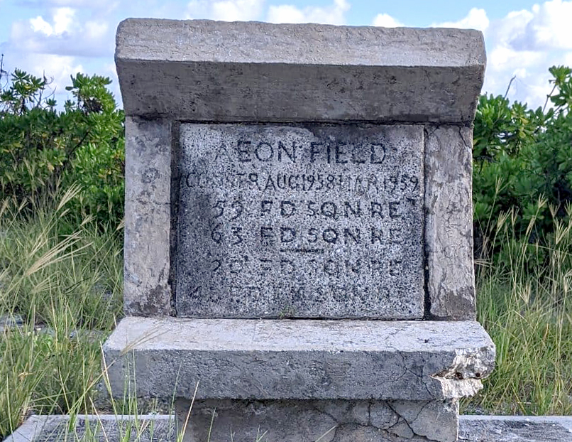
Aeon Field: Named for the best-documented vessel destroyed in the Bay of Wrecks. The Aeon, built in Australia in 1905, was wrecked just more than three years later, in 1908, on a return from San Francisco. Aboard was two million feet of lumber, Oregon fir and redwood, consigned for New Zealand and Australia. For decades this lumber littered the eastern coast of Christmas Island. When Rougier arrived and photographed the wreckage and site in 1916, the disaster was only eight years in the past, and the lumber provided material not only for Rougier and his crews, but later for both British and American military, during both the Second World War and the Cold War atomic tests. One of those Aeon castaways was Goldsborough Serpell Patrick, who was barely two years old at the time. He returned to the island in 1856, as a US Navy Rear Admiral, as one of two US observers for the British Operation Grapple.


Aeon Field was built circa 1956, in anticipation of Operation Grapple, a series of Cold War British atomic bomb tests, from 1957-59. Operation Dominic was a series of joint US/UK tests in 1962. Has this airfield been used in 65 years? Your guess is as good as mine.
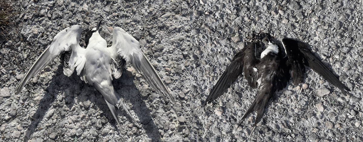
Casualty report: paying my respects by documentation. One hundred years ago, when Fr. Rougier and his men were driving around the island, they would purposely drive through colonies, sticks in hand to
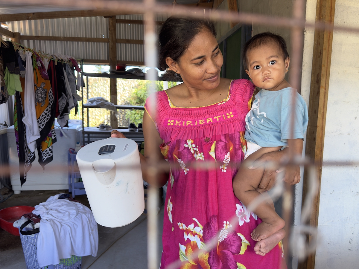
The locals call it the “Chinese store” as the owner has Chinese heritage. Managed by Robin King Kumkee, who is originally from Tarawa, his father owns the larger store back there. He married his wife, Tebwaka “Kaka” Robin, on Tarawa. She misses home, as that’s where her family is — and there are a LOT more people/conveniences there. They live with their child, Hazel Robin (I-Kiribati natives “last” names are those of their fathers or husbands).

Roiti Canter, 51, is one of the shops keepers.
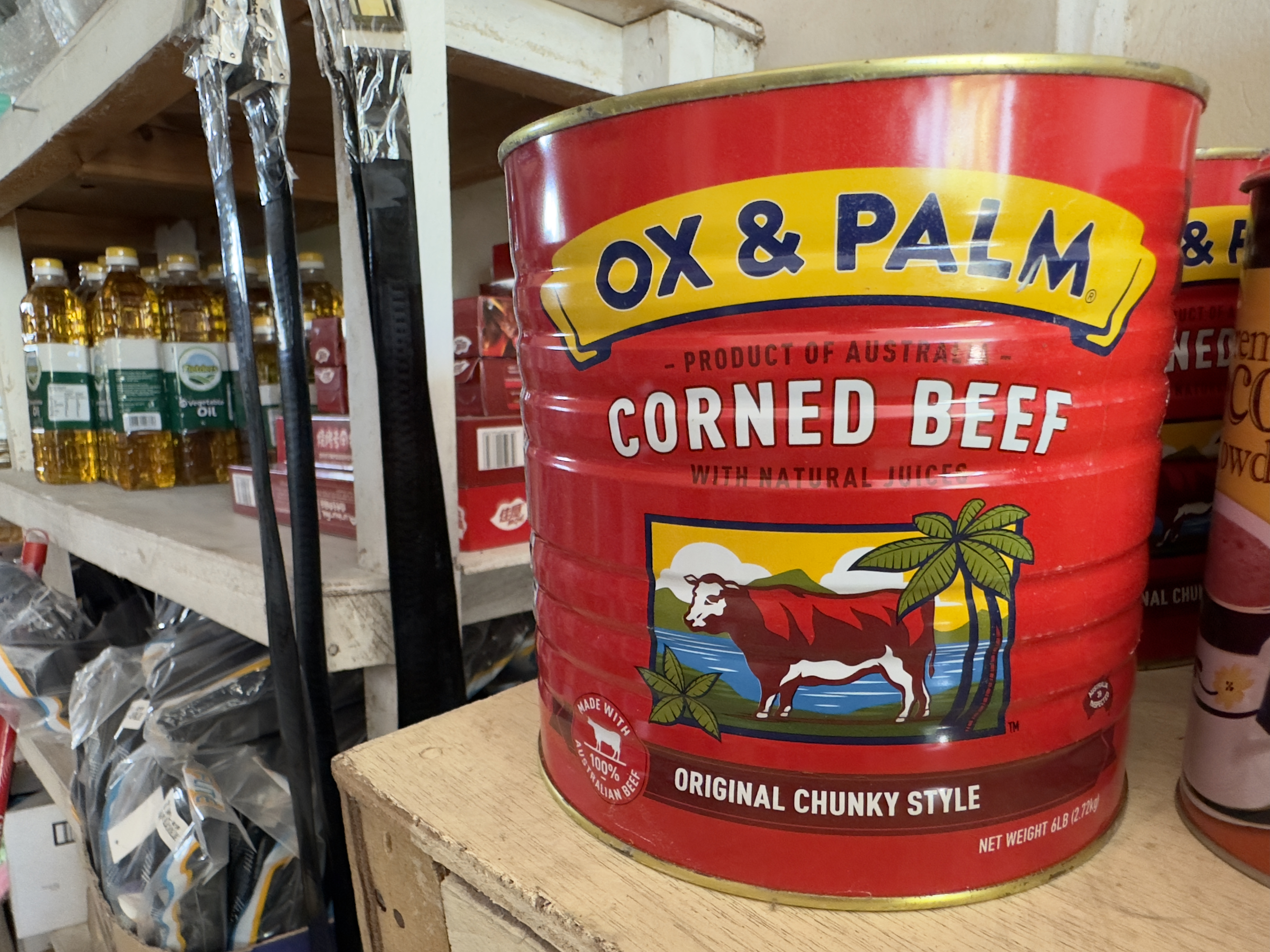
Corned beef has been commercially sold since the 1600s, with Cork, Ireland producing half of their beef exports by 1668. Though favored in Europe, in the American colonies it was deemed unworthy, and looked down upon, as only consumed by the poor or enslaved. By WWI troops on both sides of the war were tucking into cans of “Bully beef,” from the French bouilli ("boiled”), by then sold in oblong tins, with an opening “key” attached. Pre-cooked, there beef was ready to eat. By the time Joe English set foot on Christmas Island, the canned meat had no doubt already made an appearance there, as by then it saw world-wide consumption. Likewise, during the Second World War, it was not beef, but ham, or specifically spiced ham, or SPAM, that made inroads into the Pacific, accompanying the military. Both versions of tinned meats — beef and pork — are widespread in the Pacific. Hawaii sees the largest per capita consumption of Spam in the US.
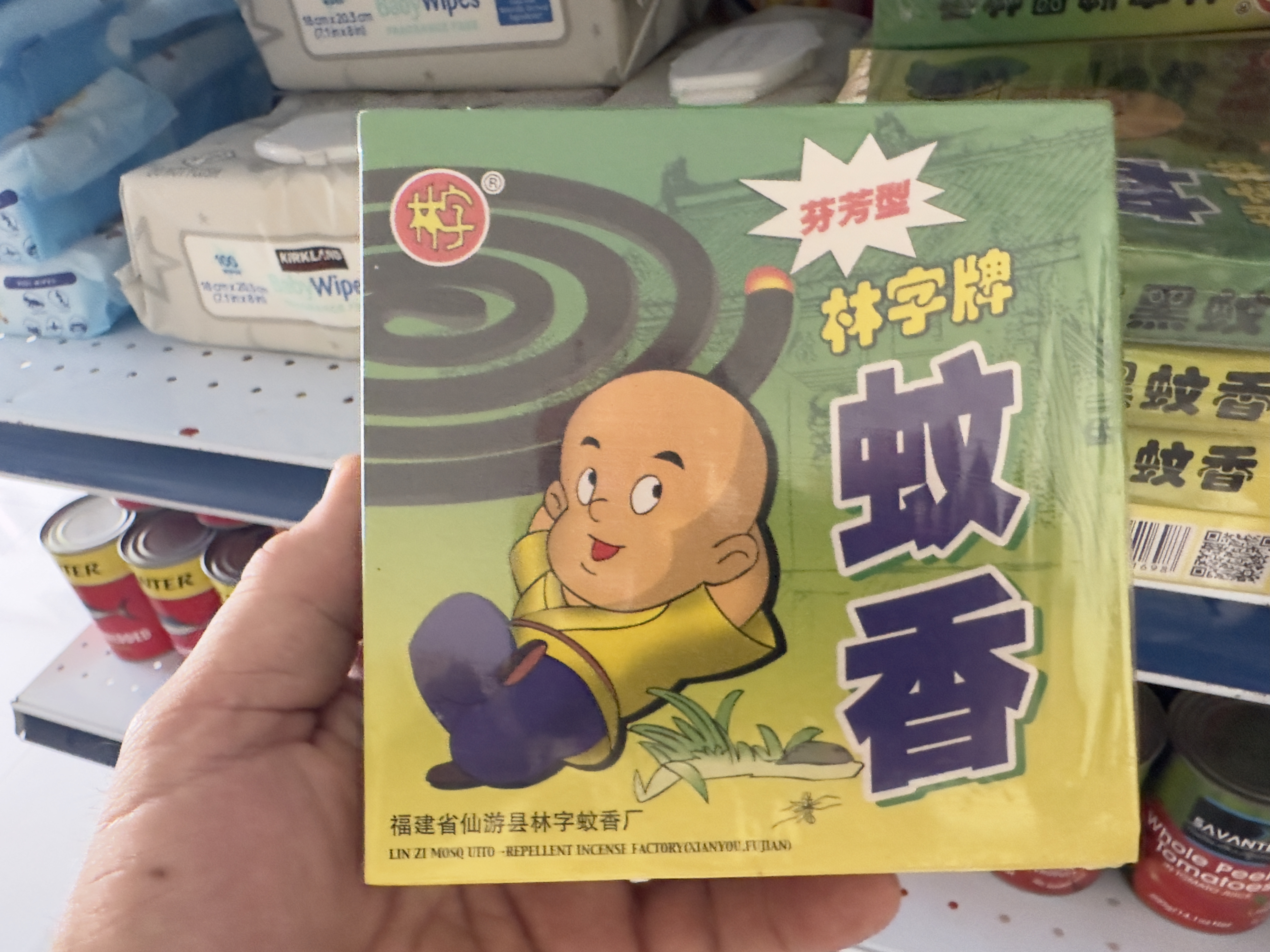
When the mosquito coil packaging includes a guy that looks like a clean-shaven — and youthful — version of myself, wearing a Chinese outfit, I buy it.